Areas › Haute-Savoie ›
L'Abray
L'Abray is a mountain walk near La Chapelle-d'Abondance, Haute-Savoie. It scores 71 out of 100 for off-lead dog walking (Not for off-lead).
| Off the lead? | No: dogs must be on a lead |
|---|---|
| Where | Mountain walk near La Chapelle-d'Abondance, Haute-Savoie |
| Size | About 910 acres (367 ha) |
| Water for a swim | There's a stream, but dogs are asked to keep out of the water. |
| Parking | There are 2 car parks on or near it. |
| Livestock | Yes, grazing here |
| Shade | 44% woodland |
| Suggested loop | 2.8 miles, about 110 minutes |
What it's like
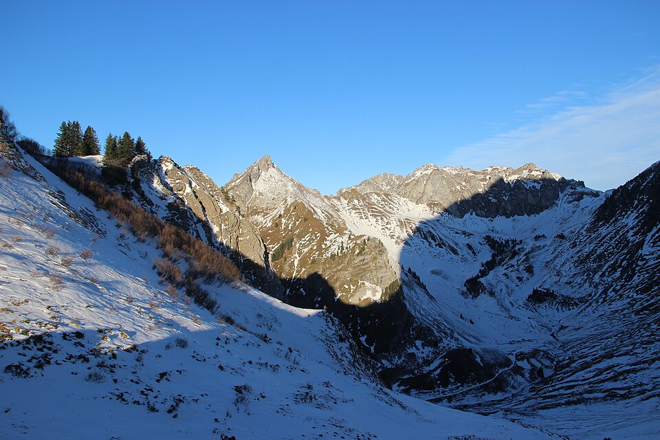
Walks from the car park, with 19 miles of paths within about a mile and a half. It starts at 1,225 m and climbs to about 1,853 m. There's a stream, but dogs are asked to keep out of the water. It's a mix of woodland and open ground. A public road runs through it, so take care near the road. There are 2 car parks on or near it. In winter part of it is ski piste.
Dogs
Official pages say dogs must be on a lead here because of grazing herds and guardian dogs. In France a dog counts as straying if it's out of earshot or more than 100 m from you.
You're responsible for your dog. Before you let it off the lead, read the signs at the entrance, look out for livestock and roads, and make sure it will come back when called.
Watch out for
- Now: It's hunting season (September to February). Driven shoots (battues) take place in the woods: look for "Chasse en cours" signs, keep your dog close, and a hi-vis vest helps.
- From 15 April to 30 June, French law says dogs in woods and forests must be on a lead whenever they're off the main forest tracks.
- From June to September cattle and sheep graze the high pastures, and flocks may be guarded by big white dogs (patous). Put your dog on a lead and go round them.
- From December to April part of this area is ski piste, where dogs usually aren't allowed.
- Now: Paths above about 1,500 m can be snowy or icy from November to May. This walk goes up to about 1,853 m.
- Mountain rivers are cold and fast, and can rise quickly after storms or when dams release water. Keep your dog out of strong currents.
- Livestock graze here. Put your dog on a lead near them.
Parking
- Car park · free · Directions
- Car park · free · Directions
Suggested loop
A 2.8-mile loop from the car park with about 440 m of climbing , about 110 minutes at a dog's pace.
Shown dashed on the map above. Drawn by computer from OpenStreetMap paths. We haven't walked it: paths can be missing, private, closed or overgrown.
Huts, cafés and restaurants
- Le Retro · Restaurant · · 1.0 mi from the car park · Directions
- La Taverne d'ici et d'ailleurs · Restaurant · · 1.0 mi from the car park · Directions
- Les Cornettes · Restaurant · · 1.0 mi from the car park · Directions
- L'Ensoleillé · Restaurant · · 1.0 mi from the car park · Directions
From OpenStreetMap. Dog policies only show where someone has mapped them, and they change. Run one of these? Get listed
Questions
Can dogs go off the lead at L'Abray?
Official pages say dogs must be on a lead here because of grazing herds and guardian dogs. In France a dog counts as straying if it's out of earshot or more than 100 m from you.
Is there parking at L'Abray?
There are 2 car parks on or near it. Parking: free.
Can dogs swim at L'Abray?
There's a stream, but dogs are asked to keep out of the water.
Are there cows or sheep at L'Abray?
Yes. Livestock graze here, so put your dog on a lead near them.
How long is a walk at L'Abray?
Our suggested loop is about 2.8 miles (4.5 km) from the car park and takes about 110 minutes at a dog's pace, with about 440 m of climbing.
Where this comes from
Official listing for the Abray footpath requires dogs on lead because of flocks and wildlife. Easy 6 km loop, open daily 1 June to 30 November, snow permitting. Guardian dogs not mentioned.
Researched online in November 2026. Nobody from Find Dog Walks has checked this place in person. Mud and shade are estimated from geology and woodland maps.
Something wrong? Open it on the map and use "Report a problem with this page", or email [email protected].